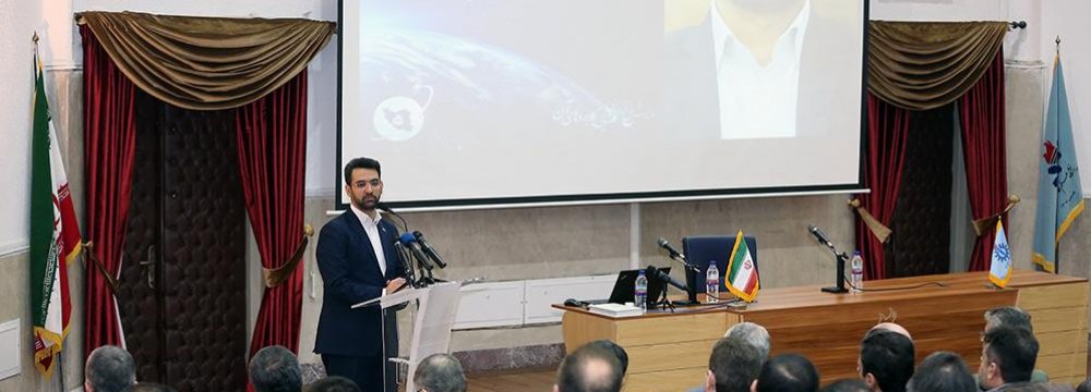
The National Conference on Space Technology and its Applications opened on Monday for three days, as part of a push to promote applications of space sciences. It merits mention that the first Iran-made satellite ‘Sina’ was launched on Oct. 28, 2005.
The university chancellor addressed reporters on Tuesday. Jabbar Ali Zakeri said IUST is the third university in Iran active in space sciences along with Sharif University of Technology and Amirkabir University of Technology, IUST website (iust.ac.ir) reported.
So far three satellites have been designed by IUST, the last of which—named Zafar—is in the final development phase, Financial Tribune reported.
“In addition to developing satellites, scientists at IUST have focused on applications of space sciences. The technology can be used in diverse fields including transportation, natural disaster mitigation and agro management.”
Payam Satellite
ICT Minister Mohammad Javad Azari Jahromi addressed the meeting. Pointing to Iran’s failed bid to send a satellite into orbit this month, Jahromi said, “An unsuccessful project must not dishearten us. A day after the failed launch of satellite Payam1, we started work on a second satellite (Payam2) that has enhanced precision compared to its predecessor.”
Iran’s bid earlier this month to put into orbit the micro-class non-military satellite Payam1 failed as its launching rocket did not reach adequate speed in the third stage.
Payam1 (message in Persian), a micro-class 100kg non-military satellite was to orbit about 500-600 km above the Earth's surface and undertake imagery and telecom tasks.
After the failed launch, several Iranian users on Twitter criticized Iran’s space program as being “wasteful”. In response to the criticism, Jahromi said, “Over the past ten years, €1.2 million was spent on production of Payam. That’s not a big amount compared to the huge investments lavished on many [fruitless] projects in Iran,” adding that the space program can create wealth and underpin the struggling economy.
Future Plans
“By September, hopefully, we will have put into orbit a remote sensing satellite with spatial resolution of 2 meters and lifespan of 2-3 years that will orbit the Earth at an altitude about 500km,” the minister said.
Another Iran-made satellite Dousti (friendship in Persian) is also in line for launch. Dousti is a micro-class 52kg satellite which will orbit the Earth at altitudes between 250km and 310km.
A technology park with focus on space science and its applications will be established in the northern Mazandaran Province in the coming months, he added.
The park will be home to knowledge-based companies in the field of space sciences and their use in agricultural management, environmental preservation and more.
Open Data Approach
Over the past few months, the government of President Hassan Rouhani has been promoting an open data approach to gather information from state agencies.
Jahromi says that if the open data approach is extended to space science, and if the satellite imagery data gathered by the government is shared with private entities, companies can help farmers with informed counseling services.
With the help of valuable and precise information, farmers can be enabled to make data-driven decisions. For instance, they can pick the best crop(s) based on ecological forecasts.
Iran is among the countries long struggling with water crisis. Space sciences and remote sensing can be employed for better management of the dwindling water reserves and other natural resources.
“The environment and natural resources are common heritage of mankind. Space sciences can help us preserve this shared wealth,” the minister said.
Golestan National Park
Over the past months, the space program and its applications including remote sensing have been pushed to the fore.
For instance, an agreement was signed between the ICT Ministry and the Department of Environment two weeks ago, as per which a project was launched in Golestan National Park to equip the globally acclaimed natural reserve in the northeast with smart fire alarm systems. Satellite imagery, remote sensing, and Internet of Things (IoT) are to be used by the system.
It is a pilot project that will be duplicated to other natural reserves if it produces the desired results.


